 |
| Unnamed grave in Pratt Pioneer Cemetery |
Highway 197 leads south from The Dalles into the wide Central Oregon plains. Here the pioneers saw grazing land and brought cattle and sheep. Dryland orchards and wheat were planted. The desert bloomed for some, but this land demands much from those who would make their living here. Tiny towns sprang up, then faded away. The railroad brought improved transportation; some made a fine living, some saw their dreams fade away in the desert dust.
 |
| Abandoned equipment near White River Falls |
Many traces of those dreams remain in place names, in the history books, and in the old buildings left behind. Some of these are in "ghost towns," but often a few hardy residents remain. Please be respectful when stopping beside abandoned structures; it might be news to some "west-siders," but just because you find an old building doesn't mean it's a museum. Respect fences, gates, and signage; you can see just fine from the road. It should go without saying that all we take is pictures; in fact, we don't even photograph private residences without permission from the owner.
 |
| Boyd granary |
Our first town is only about nine miles down 197. Watch on the left for Boyd Market Road. If you don't see it in time, no need to turn around; there is another left turn just past the first, and the two meet up.
Boyd dates back to around 1870, when it was settled near a popular spot to cross Fifteenmile Creek. The town once boasted a store, a granary, a mill, a school, a post office, and a church. Bypassed by the highway, the community lost its railroad access in the 1930s. Not much remains today. Drive past the few residences (some abandoned, some still occupied) to find the tall, sturdy granary built by T. P. Boyd in 1883. An old barn occupies the hill behind it. Return to Highway 197 the way you came.
 |
| Antique oil rig |


A few miles south, turn right to visit the still-living pioneer town of
Dufur (motto: "Ask not what you can do for Dufur, but what Dufur can do for you"). Established in the 1870s, this farming town made a convenient stop between The Dalles and Wapinitia. Fruit trees, wheat, and grapes are still grown around a community that is proud of its history. Check out the stately brick
Balch Hotel. Built in 1907, it is still renting rooms. On the other side of Fifteenmile Creek stands an impressive compound comprising the
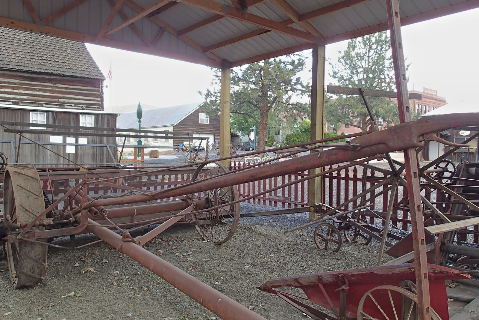
Dufur Living History Museum. A two-story log cabin houses displays, and a schoolhouse built in 1892 has been moved here from the nearby settlement of Endersby. While the indoor exhibits were inexplicably closed during our recent visit, we spent a long time in the outdoor display of vintage farm equipment. This extensive exhibit provides signage explaining the use of the equipment, most of which was horse-drawn. While there, look for another lost dream: an antique oil rig. Despite high hopes, oil was never found in the surrounding hills.

Back on 197, cross Tygh Ridge, drive through Butler Canyon, and take a left turn onto Highway 216 to
White River Falls State Park. The picnic area offers an excellent view of the falls and canyon, but for a closer look walk down the steep dirt path. The White River, born on the slopes of Mt. Hood, plunges and froths through the canyon it has carved. Beside the falls sits an eerie abandoned powerhouse that supplied nearby towns from 1910 to 1960; the gaping doors reveal glimpses of the old turbines still inside.

Continue on narrow Highway 216 to see the site of
Sherar's hotel and toll bridge, where
Joseph and Jane Sherar hosted countless travelers in Oregon's early days. Nothing remains of their settlement today; the land is tribally owned, and a
day-use fee is charged. This rugged section of the Deschutes, with its powerful waterfall, is a traditional fishing site for Native Americans.


Return to 197 and cross the highway to find the small, sleepy community of Tygh Valley. Follow the main road through town to Wamic Market Road. This road quickly climbs to reveal breathtaking views of the beautiful Tygh Valley. Drive 5.5 miles to the friendly little town of
Wamic, the "Gateway to the
Barlow Road." You will find a well-preserved schoolhouse, moved to this location from nearby Smock Prairie; according to the local folks, nothing remains of that old community but the schoolhouse you see here. You will also find the picturesque Pratt House; in fact, Wamic was originally known as "Prattville." Continue down the gravel street to find a tiny, rugged pioneer cemetery tucked underneath the pine trees.
Retrace your route back to 197 and drive toward Maupin, where we will spend some time beside the Deschutes and top off our gas tank before exploring the Wapinitia Highway.
 |
| Balch Hotel, Dufur |
 |
| Antique farm equipment, Dufur |
 |
| Antique car, painted pink, with a wooden pole and metal barrel attached to the back. Explanations welcome. |
 |
| Endersby Schoolhouse, Dufur |
 |
| White River Falls from parking lot |
 |
| White River Falls from lower viewpoint |
 |
| Abandoned dam near White River Falls. Note the "1910" plaque in the lower left corner. |
 |
| White River Canyon, with powerhouse visible |
 |
| Powerhouse at White River Falls |
 |
| A peek though the doorway at the turbines inside |
 |
| Site of Sherar's Hotel and Toll Bridge |
 |
| Historic Pratt House in Wamic, now a private residence. Photo taken with permission from owner. |


 |
| Smock Prairie Schoolhouse, Wamic |
 |
| Tygh Valley |


 A few miles south, turn right to visit the still-living pioneer town of Dufur (motto: "Ask not what you can do for Dufur, but what Dufur can do for you"). Established in the 1870s, this farming town made a convenient stop between The Dalles and Wapinitia. Fruit trees, wheat, and grapes are still grown around a community that is proud of its history. Check out the stately brick Balch Hotel. Built in 1907, it is still renting rooms. On the other side of Fifteenmile Creek stands an impressive compound comprising the Dufur Living History Museum. A two-story log cabin houses displays, and a schoolhouse built in 1892 has been moved here from the nearby settlement of Endersby. While the indoor exhibits were inexplicably closed during our recent visit, we spent a long time in the outdoor display of vintage farm equipment. This extensive exhibit provides signage explaining the use of the equipment, most of which was horse-drawn. While there, look for another lost dream: an antique oil rig. Despite high hopes, oil was never found in the surrounding hills.
 Back on 197, cross Tygh Ridge, drive through Butler Canyon, and take a left turn onto Highway 216 to White River Falls State Park. The picnic area offers an excellent view of the falls and canyon, but for a closer look walk down the steep dirt path. The White River, born on the slopes of Mt. Hood, plunges and froths through the canyon it has carved. Beside the falls sits an eerie abandoned powerhouse that supplied nearby towns from 1910 to 1960; the gaping doors reveal glimpses of the old turbines still inside.
 Continue on narrow Highway 216 to see the site of Sherar's hotel and toll bridge, where Joseph and Jane Sherar hosted countless travelers in Oregon's early days. Nothing remains of their settlement today; the land is tribally owned, and a day-use fee is charged. This rugged section of the Deschutes, with its powerful waterfall, is a traditional fishing site for Native Americans.
 Return to 197 and cross the highway to find the small, sleepy community of Tygh Valley. Follow the main road through town to Wamic Market Road. This road quickly climbs to reveal breathtaking views of the beautiful Tygh Valley. Drive 5.5 miles to the friendly little town of Wamic, the "Gateway to the Barlow Road." You will find a well-preserved schoolhouse, moved to this location from nearby Smock Prairie; according to the local folks, nothing remains of that old community but the schoolhouse you see here. You will also find the picturesque Pratt House; in fact, Wamic was originally known as "Prattville." Continue down the gravel street to find a tiny, rugged pioneer cemetery tucked underneath the pine trees.


No comments:
Post a Comment