 This unique hike offers an incredible variety of jaw-dropping views in under 20 miles, but it doesn't come easily. We wanted to do the loop for years, but could never get all of the pieces together. First, the Old McKenzie Pass (Highway 242) has to be open. On a good year, this is from the end of June until maybe October; it is a high, remote passage and subject to closure by snow. Second, you need a permit from the Forest Service, and if you have not gotten one in April you will need to try to grab one when they release the remainder a week prior to your entry date. Third, the trail tends to hold onto snow late into the season, especially the PCT section, and it would be very easy to get lost in this huge wilderness unless you are accustomed to snow hiking with a GPS. Fourth, if you want the views, the weather has to be clear, and mountain tops often hide their heads in the clouds. And fifth, if you are like us, you have to get the time off of work.
 But it finally happened. The planets aligned for us and we drove out Highway 242 to the Obsidian Trailhead one fine morning and even located a parking place. There was a ranger waiting to check our permit; he was to reappear three more times over the course of our hike, so don't think it's something you can omit.
At this point we should perhaps mention that you will also need your sturdiest boots, a walking stick or trekking poles, good maps, and the ability to carry plenty of water. Dogs should have boots to protect their paws in the obsidian and lava areas.
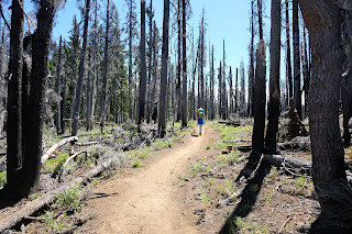
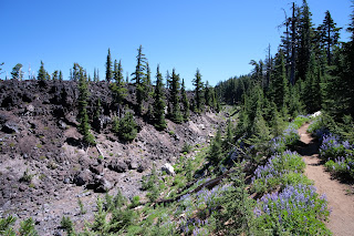
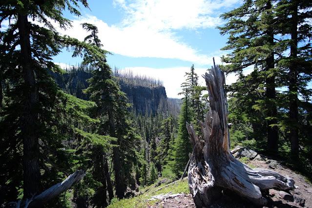
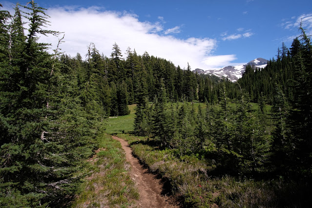
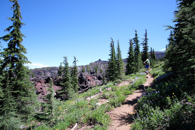
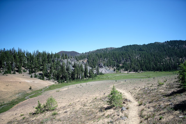
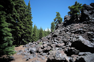 Begin hiking uphill (get used to it, there is a lot of uphill, more uphill than seems logical) through the forest. A trail to the right marked as "not maintained" is worth missing; it once went to Spring Lake at the foot of Sim's Butte, but a recent burn has made it fairly impassible. Continue through forest, a short burned area, more forest, and arrive at a wall of lava at the three-mile point. Follow the well-maintained trail through the lava field and continue to climb to a junction near White Branch Creek at around four miles. Now you have a decision to make: take the trail to the left and hike Glacier Way for less than a mile to camp at Sunshine Meadows, or take the trail to the right for around a mile and camp in the Obsidian area. If you choose the lush wildflower meadow at Sunshine, you will definitely want to head south on a side trip to see the Obsidian area, as well.
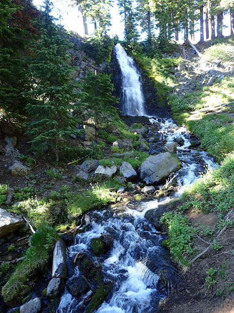
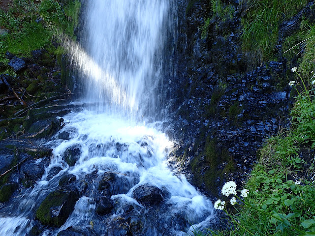
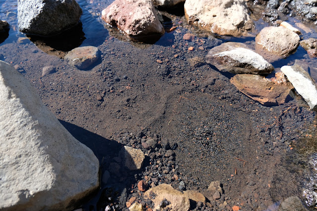
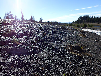 One square mile of obsidian. Shining, black glass lying over acre after acre. Huge boulders of black volcanic glass. And next to it, Sisters Spring bursts from the base of an enormous cliff and trickles across a mountainside meadow until it pours through a small slot into 20-foot Obsidian Falls. If this is not enough, you will begin to catch views of the surrounding Cascades and find many lovely campsites off of the trails and away from the water.
 This hike can be done as a lollipop loop of 11.5 miles, and it offers so much that is absolutely worth every step. But if, like us, you finally got your planets to align and you want to make the most of your visit, there is a bigger loop using the PCT and Scott trails to make a 17.5 mile loop. This offers even more variety and views, at the cost of a long, dusty hike out and a short trek along the road.
To take the long loop, head north from Sunshine Meadows or Obsidian Falls on the PCT. Fill your water bottles first. This section looks deceptively short on the maps; don't believe it, allow plenty of time.
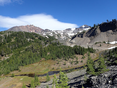
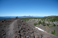
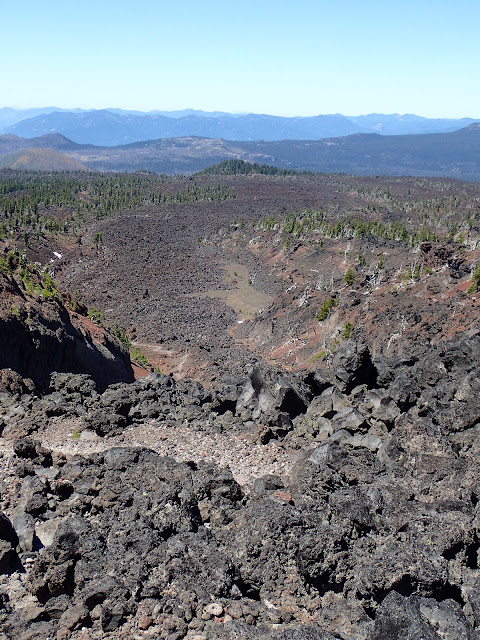
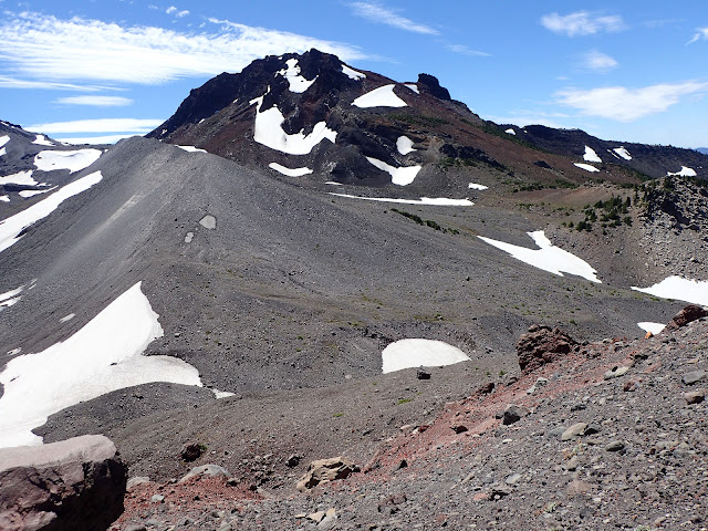
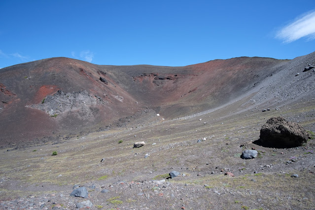
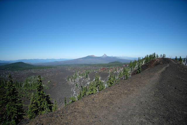
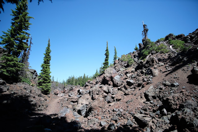
Climb, first through the forest and then alongside the edge of another lava flow. Then begin hiking through the lava field and over Opie Dildock Pass. This is a wildly rugged landscape, dotted with the silver skeletons of trees that tried to make a go of it and failed. Climb until you find yourself in a sort of box canyon with a wall of crumbled lava at the end. This is your trail.
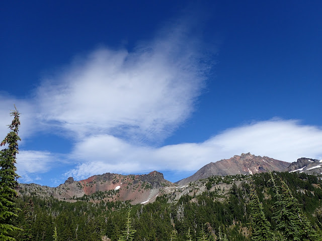
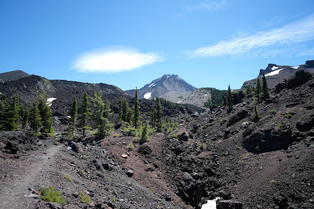
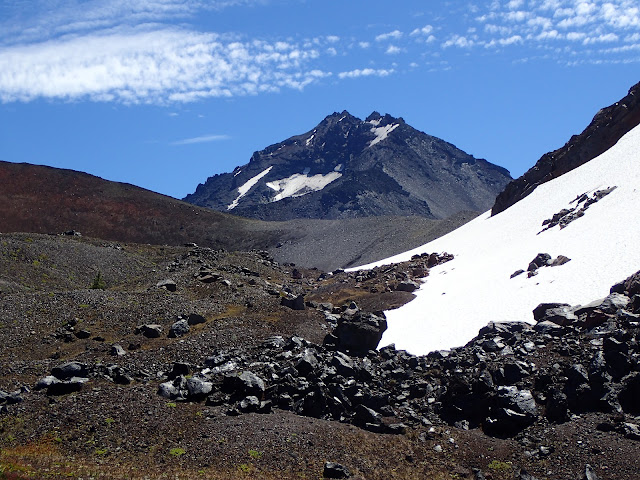
Switchback up the wall and pass along a lava fin. Continue until Collier Cone looms ahead (crumbly scramble trails allow for exploration for those bold enough). North Sister looms above the cone, with Middle Sister peeking coyly alongside.
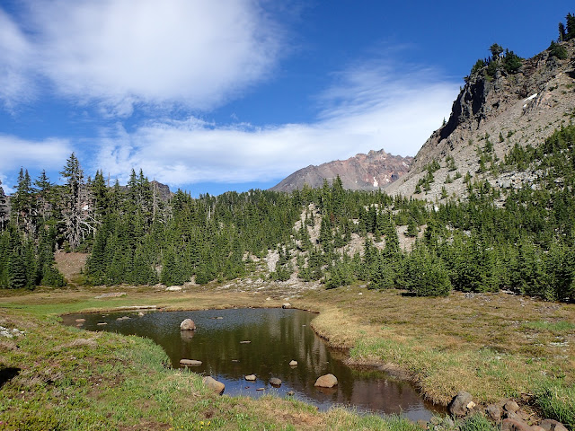
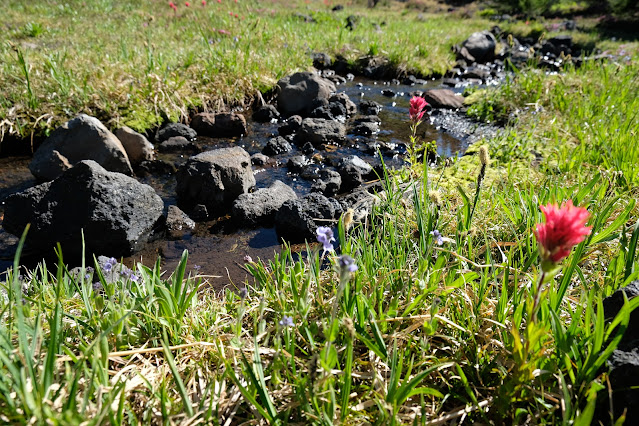
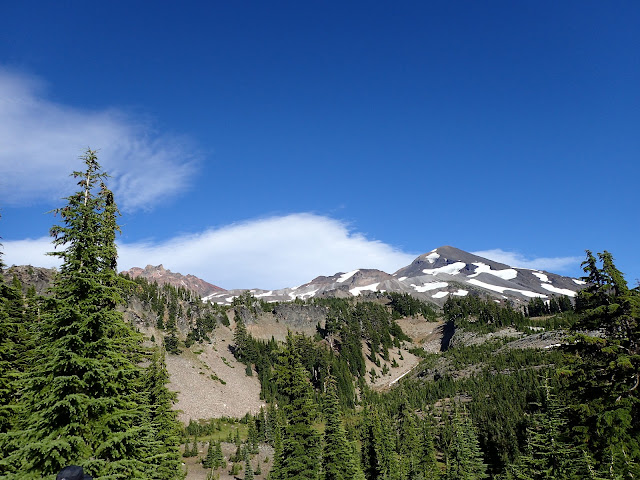
 Continue through the rugged landscape with more views of the Cascades; on a clear day one may spot Mt. Washington, Three Fingered Jack, Mt. Jefferson, Mt. Hood, and Mt. Adams. At long last arrive at Minnie Scott Springs, a beautiful, fragile oasis and probably your last water source. Look in the trees on the ridges above to find camp sites.
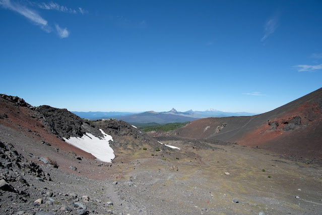
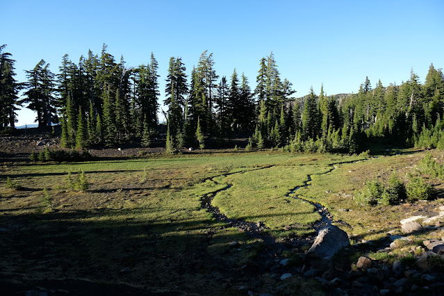
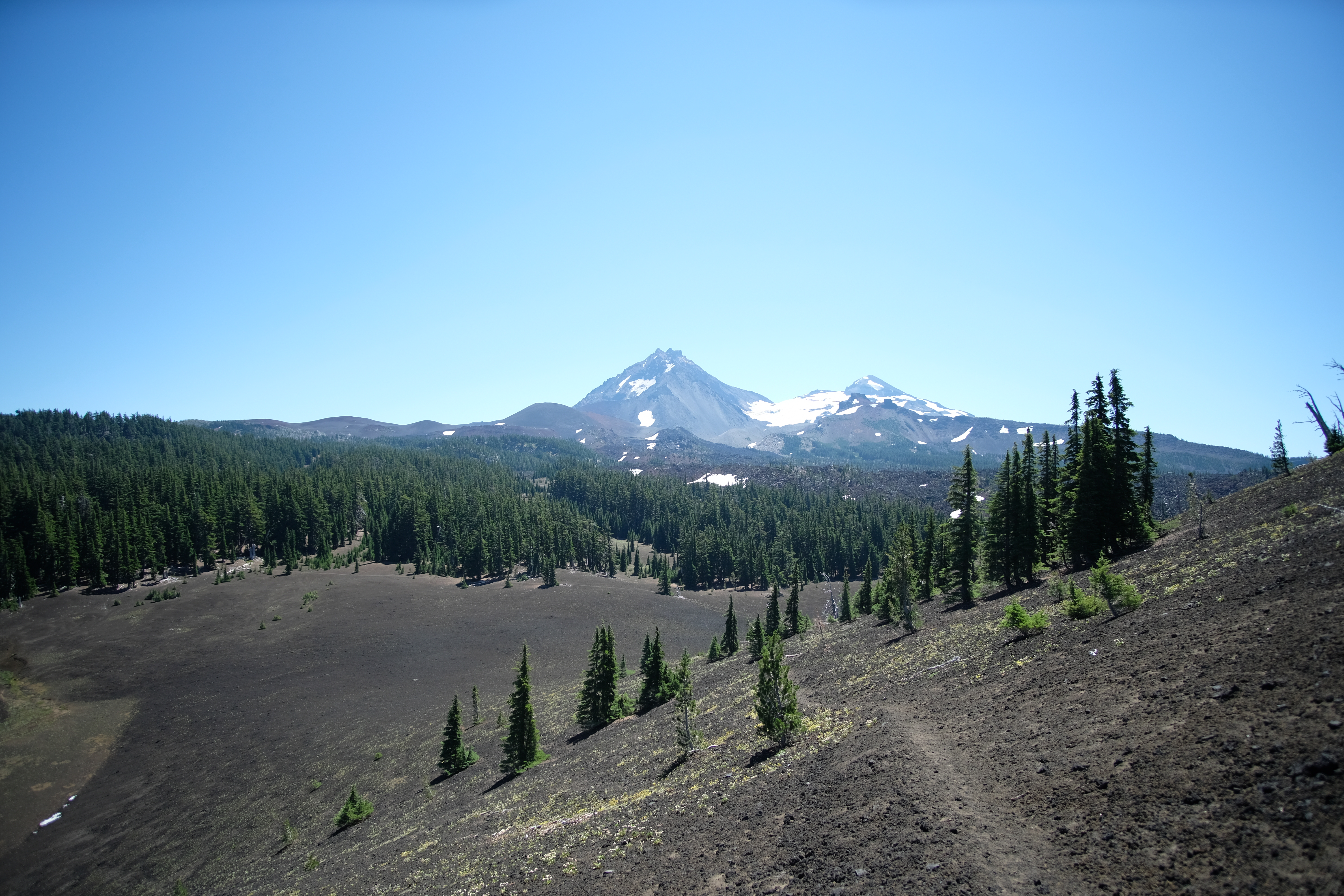
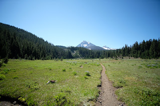 Continue to climb on the PCT through sparse forest to a wide meadow filled with a variety of wildflowers in season. Look behind you for an up-close view of North Sister, Middle Sister, and Little Brother. Cross the meadow and watch for the Scott Trail on your left (continue briefly on the PCT if you wish to explore Yapoah Crater, a massive cone with scramble trails).
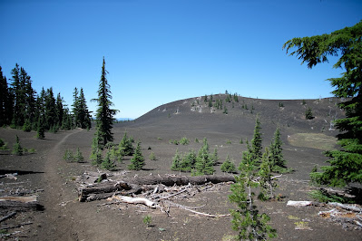 |
| Four-in-One Cone |
This next section is a long, dusty pull of over five miles through lava and forest, but Four-in-One Cone provides a welcome side trip and a good, if unmaintained, trail to the top. After that, expect a descent through sparse woods and sections of lava; this part of the trail was originally a segment of Felix Scott's Trans-Cascade road, built in the mid-1800s.
Emerge onto Highway 242. There used to be a tie trail to make this into a nice, neat loop, but it has been inexplicably closed, leaving hikers to walk about half a mile along a narrow pavement with no shoulders and somewhat limited traffic sight lines. Be cautious on this part of the journey until you meet back up with your car at the trailhead.
 This is a rather unfortunate fizzle of an ending to a truly spectacular hike, but don't let it deter you from taking the longer loop. The views and wild landscape are well worth a bit of a trudge at the end.
Regardless of whether you choose the long loop or the short loop, this is not an easy hike; it is a rugged, volcanic land. If you are up to the hike, though, and the planets align for you, don't hesitate to drive out the Old McKenzie Pass and explore this wild country for yourself.
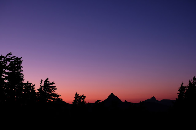
It was worth the wait.
 |
Obsidian Cliffs
|
 |
| North and Middle Sister |
 |
| Sunshine Meadows |
 |
| Little Brother |
 |
| Little Brother and Middle Sister from Obsidian Trail |
 |
| Arrowhead Lake |
 |
| Sisters Spring |
 |
| Obsidian Falls |
 |
| That's not just wet. That's glass. |
 |
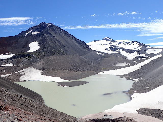
| Obsidian and, for some reason, a perfectly round lake. |
 |
| You thought we were kidding about the square mile of obsidian |
 |
| Sawyer Bar |
 |
| North Sister and Little Brother |
 |
| At the top of Opie Dildock Pass |
 |
| Unnamed rock. We like to think of it as the Eye of Sauron. |
 |
| Inside Collier Cone |
 |
| North and Middle Sisters, Little Brother just off frame to the right. A climb up the lower flank of the cone rewards you with this view of an unnamed lake. |
 |
| Little Brother and part of Collier Cone |
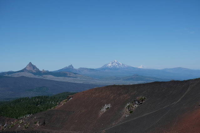 |
| Here we go, left to right: Washington, Three-Fingered Jack, Jefferson, Hood, and just barely visible, Adams. Collier Cone foreground. |
 |
| Inside the cone |
 |
| Cone overview |
 |
| Cliff over Minnie Scott Springs |
 |
| Minnie Scott |
 |
| The bubbling headwaters of the spring |
 |
| Minnie Scott Springs from camping area |
 |
| Jefferson and Three-Fingered Jack at sunset |
 |
| Meadow near Scott Trail |
 |
| "Old Man of the Mountain" |
 |
| Looking back from the Scott Trail |
 |
| Four-in-One Cone |
 |
| Crest of Four-in-One Cone |
 |
| And on our way out. May the planets align for you! |
 But it finally happened. The planets aligned for us and we drove out Highway 242 to the Obsidian Trailhead one fine morning and even located a parking place. There was a ranger waiting to check our permit; he was to reappear three more times over the course of our hike, so don't think it's something you can omit.
  Begin hiking uphill (get used to it, there is a lot of uphill, more uphill than seems logical) through the forest. A trail to the right marked as "not maintained" is worth missing; it once went to Spring Lake at the foot of Sim's Butte, but a recent burn has made it fairly impassible. Continue through forest, a short burned area, more forest, and arrive at a wall of lava at the three-mile point. Follow the well-maintained trail through the lava field and continue to climb to a junction near White Branch Creek at around four miles. Now you have a decision to make: take the trail to the left and hike Glacier Way for less than a mile to camp at Sunshine Meadows, or take the trail to the right for around a mile and camp in the Obsidian area. If you choose the lush wildflower meadow at Sunshine, you will definitely want to head south on a side trip to see the Obsidian area, as well.
 This hike can be done as a lollipop loop of 11.5 miles, and it offers so much that is absolutely worth every step. But if, like us, you finally got your planets to align and you want to make the most of your visit, there is a bigger loop using the PCT and Scott trails to make a 17.5 mile loop. This offers even more variety and views, at the cost of a long, dusty hike out and a short trek along the road.
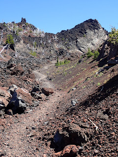
 Continue through the rugged landscape with more views of the Cascades; on a clear day one may spot Mt. Washington, Three Fingered Jack, Mt. Jefferson, Mt. Hood, and Mt. Adams. At long last arrive at Minnie Scott Springs, a beautiful, fragile oasis and probably your last water source. Look in the trees on the ridges above to find camp sites.
 Continue to climb on the PCT through sparse forest to a wide meadow filled with a variety of wildflowers in season. Look behind you for an up-close view of North Sister, Middle Sister, and Little Brother. Cross the meadow and watch for the Scott Trail on your left (continue briefly on the PCT if you wish to explore Yapoah Crater, a massive cone with scramble trails).
 This is a rather unfortunate fizzle of an ending to a truly spectacular hike, but don't let it deter you from taking the longer loop. The views and wild landscape are well worth a bit of a trudge at the end.


Thanks Sally and Austen! Great write up and pictures. I spent my childhood and early adulthood all over that area, but have not been back for years. You've stirred up some great memories for me, and I'm really pleased for you, that you've gotten to enjoy that very special place!
ReplyDeleteAt this point we should perhaps mention that you will also need your sturdiest boots, a walking stick or trekking poles, good maps, and the ability to carry plenty of water. Dogs should have boots to protect their paws in the obsidian and lava areas.
ReplyDeletecricut black friday
list of cricut fonts with shadows
cricut vinyl stickers
meaningful heart beat tattoo
cricut custom design